Bavarian State Library

The Bavarian State Library keeps an extensive treasure trove of historical maps from all over the world. Numerous map sheets document the political, economic and spatial development of Bavaria. The oldest maps date from the 16th century, the main focus of the collection is in the 19th century.
The "Bayerische Landesbibliothek Online" (![]() https://www.bayerische-landesbibliothek-online.de/histkarten) publishes a selection of the most beautiful and valuable specimens from four centuries of this collection on this website. It is possible to search for headlines, authors, production techniques and years of publication. Historical maps of individual locations in Bavaria can be found via a location database.
https://www.bayerische-landesbibliothek-online.de/histkarten) publishes a selection of the most beautiful and valuable specimens from four centuries of this collection on this website. It is possible to search for headlines, authors, production techniques and years of publication. Historical maps of individual locations in Bavaria can be found via a location database.
"Virtual Map Forum" of Deutsche Fotothek

The Kartenforum is an information portal for libraries, museums and archives maintained by the Deutsche Fotothek and funded by the DFG. Currently, over 30,000 of the most important, high-resolution digitized cartographic sources - in particular on the history and regional studies of Saxony - are offered from the collections of the partners involved ( ![]() http://www.deutschefotothek.de/db/apsisa.dll/ete?action=queryInfo&index=area&desc=Kartenforum).
http://www.deutschefotothek.de/db/apsisa.dll/ete?action=queryInfo&index=area&desc=Kartenforum).
As part of the DFG project "Exemplary Digitization and Publication of Historical Maps and Views" (2009-2011), around 6,000 measuring table sheets on a scale of 1: 25,000 and the map of the German Empire on a scale of 1: 100,000 are prepared in the sense of a comprehensive basic cartographic offer for scientific use provided from all disciplines. In addition, the Virtual Map Forum 2.0 offers research in over 9,000 geo-referenced maps. The display of historical maps in 3D is new. Since 2018, the first Saxon topographical land survey from 1780-1806 on a scale of 1:12,000 (367 "miles sheets") has been completely georeferenced in the Virtual Map Forum.
State and University Library Bremen

The State and University Library Bremen (![]() gauss.suub.uni-bremen.de/) has a historical map inventory of approx. 3,800 digitized maps that are available on the Internet. Regional and overview maps of northwest Germany and various European countries as well as city maps and city views from the European area form the main focus of the historical map inventory. The collection areas also include Asia, Africa and America. There are also road, postal route, railway and expedition maps as well as a number of military maps. The maps of the cartographer and publisher Johann Baptist Homann (1664-1724) and his heirs dominate the holdings of the 18th century. In addition, the maps of the cartographers and map publishers Seutter and Lotter can be found more often. The maps of the 19th and especially the 20th century are predominantly maps of Germany and Europe.
gauss.suub.uni-bremen.de/) has a historical map inventory of approx. 3,800 digitized maps that are available on the Internet. Regional and overview maps of northwest Germany and various European countries as well as city maps and city views from the European area form the main focus of the historical map inventory. The collection areas also include Asia, Africa and America. There are also road, postal route, railway and expedition maps as well as a number of military maps. The maps of the cartographer and publisher Johann Baptist Homann (1664-1724) and his heirs dominate the holdings of the 18th century. In addition, the maps of the cartographers and map publishers Seutter and Lotter can be found more often. The maps of the 19th and especially the 20th century are predominantly maps of Germany and Europe.
Database of old maps "IKAR" (State Library Berlin)
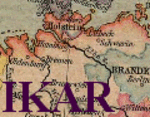
In 1985, on the initiative of the German Research Foundation (DFG) and the three largest map collections in German libraries, the Bavarian State Library in Munich, the Lower Saxony State and University Library in Göttingen and the State Library in Berlin, the national cataloging project began.
The database (![]() http://ikar.staatsbibliothek-berlin.de/) primarily shows old printed maps: world maps and city maps of all countries, topographical and thematic maps, atlases with individual sheet references, panoramas, bird's eye view maps, profiles and globes, also facsimiles and electronic resources from the collections of the participating libraries.
http://ikar.staatsbibliothek-berlin.de/) primarily shows old printed maps: world maps and city maps of all countries, topographical and thematic maps, atlases with individual sheet references, panoramas, bird's eye view maps, profiles and globes, also facsimiles and electronic resources from the collections of the participating libraries.
The original target of the development project, to include only printed maps up to the year of publication 1850, has now been relaxed. Individual collections therefore also recorded their cartographic holdings published after 1850. The database contains, among other things, online resources for over 5,000 digitized old maps (as of April 2016). Objectively, the recorded maps are indexed according to geographical references (standardized geographical keywords) and according to objects of representation.
Harold B. Lee Library of Brigham Young University (BYU) in Utah (USA)

The Harold B. Lee Library (HBLL) is the main academic library of Brigham Young University (BYU) located in Provo, Utah (![]() http://contentdm.lib.byu.edu/cdm/singleitem/collection/GermanyMaps/id/2326/rec/1).
http://contentdm.lib.byu.edu/cdm/singleitem/collection/GermanyMaps/id/2326/rec/1).
The library holds roughly 3,200 Germany maps at 1:25,000 scale. This set covers all of pre-WWII Germany, which now includes all of the Federal Republic as well as a good part of Poland. This Germany set was obtained by the British right after the war, and later given to the U. S. Army. Even though some of the printing dates run into the 1950s, most of the data found on the maps is from the 1930s and 1940s. The map sheets are laid out in a numbered grid pattern, running north to south and west to east, with the numbers increasing by 100 with each succeeding row.
GlobMapLab. The virtual map portal (Perthes Collection)

The Perthes Collection represents one of the few completely preserved cartographic publisher's archives in Germany. The company made a significant contribution to the scientific exploration, mapping and surveying of the earth in the 19th and early 20th centuries.
In the cohesion and interweaving of its holdings, the collection documents the last phase of the age of discovery, during which the interior of the non-European continents and the polar regions were explored. The maps, atlases and magazines published by Perthes, especially “Stieler's Handatlas” and “Petermanns Geographische Mitteilungen”, shaped the scientific image of the earth well into the 20th century and popularized it for a broad public.
The Perthes Collection was acquired by the Free State of Thuringia in 2003 with the support of the Kulturstiftung der Länder and integrated into the Gotha Research Library of the University of Erfurt. In addition to a cartographic and geographical specialist library with 120,000 volumes and a map collection of 185,000 sheets, it includes the archive of over 200 years of publishing history.
A selection of digitized maps and archive materials is in the "GlobMapLab.The virtual map portal (Perthes Collection)" accessible ( ![]() https://perthes-digital.de/).
https://perthes-digital.de/).