Searching for relics of old mining history in the Orla Valley
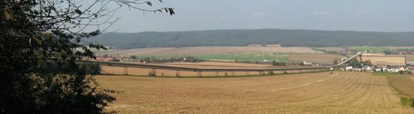
The Orlasenke encloses the approximately 3-5 km wide and 32 km long terrain depression in the Zechstein Formation between the Thuringian Slate Mountains in the south and the Saale-Elster-Buntsandstein-Plate in the north. Here, between Saalfeld and Könitz, lies the historically most important mining area in East Thuringia with an unparalleled density and variety of historical mining relics. This historic space was selected as a project area in the 2014/15 winter semester for the subject “Historical Cultural Landscapes”.
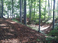
The beginnings of mining can be traced back to the Bronze Age. After the Thirty Years' War, iron ore mining became particularly important. Thanks to the near-surface location, mining could initially be carried out with the simplest means. Numerous mining holes and mining dumps - mostly hidden under bushes and trees - still characterize the landscape around Könitz today. On the & quot; Eisenstraße & quot; A large part of the ore was transported to smelters and hammer mills in the Thuringian Forest.
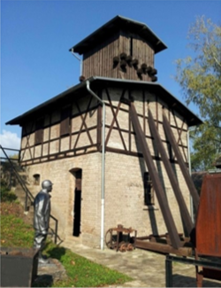
Today the "Kamsdorf Montanlehrpfad" opens up the extensive historical mining area. In addition to the mining holes and dumps already mentioned, these include mine tunnels and their mouth holes, opencast mines and mining buildings such as the "Revierhaus" built in 1822, the shaft building and the machine house of the "Ersatzschacht" from 1904. It is the only shaft ensemble under Monument protection that has survived from the last epoch of iron ore and iron limestone mining and is as visitor mine & quot; United Reviere Kamsdorf & quot; open to the public.
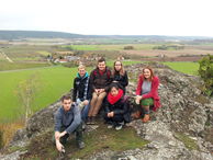
The task of the project work was to record, describe and document selected elements of the cultural landscape, to assess their condition and to make suggestions for conservation, protection and, where possible, for better perceptibility and experience. For this purpose, a day trip to the investigation area took place on November 4th, 2014. Visits to libraries, archives and interviews with regional experts deepened the research.
(photo: H.-H. Meyer)
(photo: H.-H. Meyer)
(photo: H.-H. Meyer)
(photo: H.-H. Meyer)
(photo: H.-H. Meyer)
(photo: H.-H. Meyer)
Selected theses
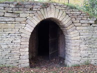
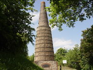
- Kalkofen bei Koenitz MaikeSach.pdfM. Sach: The historical lime kiln in Könitz
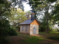
- Bethaus Leoshalde J Perwo Portal.pdfJ. Perwo: Old miners' chapel ("prayer house") and "Leoshalde" near Könitz
- Anna Heil Pingen u Halden Portal.pdfA. Heil: Mining holes and mining dumps near Goßwitz